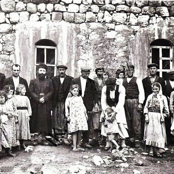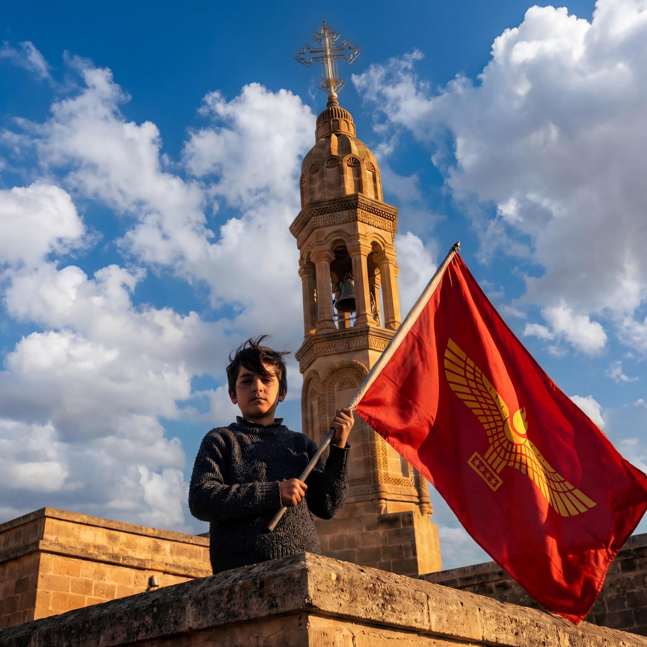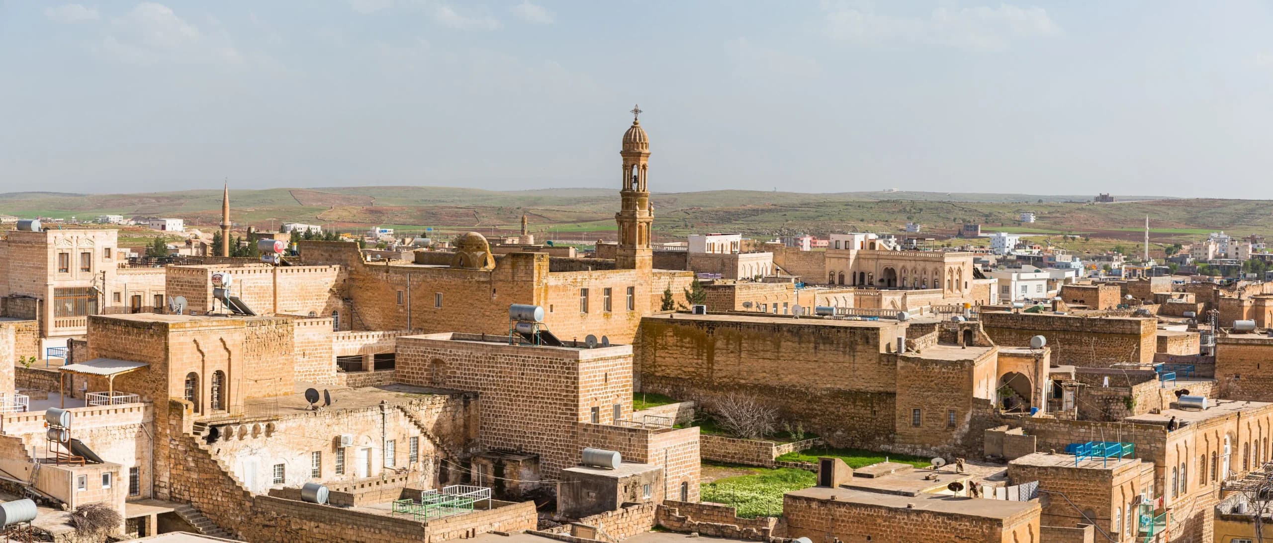
The native Aramean population of Tur Abdin, historically known as Syriacs or Suryoye, represents one of the most enduring indigenous communities of the Mesopotamian cultural landscape. Tur Abdin has long served as a historic homeland for the Aramean people in southeastern Turkey, where ancient monasteries, villages, and religious traditions reflect a continuous presence spanning centuries. Despite periods of imperial rule, political upheaval, and demographic change, the Aramean population of Tur Abdin has preserved a distinct ethno-religious identity rooted in the Syriac language, Christian liturgy, and strong ties to ancestral communities. Today, the native Aramean population of Tur Abdin remains a remarkable example of cultural continuity and resilience in the Middle East.
Origins of the Arameans in Tur Abdin
The history of the Aramean presence in the region of Tur Abdin is documented as early as the 13th century B.C., a period in which tribes of Aramean stock were already attested near the mountain range. The Assyrians designated the Tur Abdin range as Kašiāri (or Kašiyari), adapting a locally used toponym that is also attested in Hittite sources as Kašiāri or Gāšiāri. This name originally referred to an area under Hurrian (Mittani) control, and it is well possible that the toponym is derived from the Hurrian language. The earliest attestation for Kašiāri in Assyrian sources is found in the inscriptions of Adad-nirari I (1300–1270 B.C.) and Shalmaneser I (1269–1241 B.C.), who mention conquering the region. However, by the 12th century B.C., while the region was still predominantly Hurrian, Arameans were clearly active in the Tur Abdin region.
Actual direct documentation of Aramean tribes dates from the 13th century; for instance, Middle Assyrian administrative records from Tell Billa, dating to the first third of the 13th century B.C., mention the Bēt-Za-ma-ni tribe. This group was settled in or occupied the region north of Tur Abdin near Amida, modern Diyarbakır. The text indicates that the tribe was already settled in this region in the early 13th century but does not mention the chief town of the province; however, it implies the tribe constituted the bulk of the local population. Additionally, a letter sent in the 13th century from Assyria to Dūr-Kurigalzu (Aqarqūf) reports that an Assyrian army commander pursued a band (hurādu) of Hirana warriors who had joined forces with Hasmi tribesmen. These Hirana individuals were qualified in contemporary texts as Ahlamū.
A settlement of the Hiranu tribe was later noted by Ashurnasirpal II near the western area of Tur Abdin, and the tribe is encountered in the 8th century B.C. in southern Mesopotamia, where it gave its name to the city of Hirān close to Sippar. Another town called Hirāna is attested east of the Tigris, south of modern Kirkuk, where clans settled around the sanctuary of the god Be'lān ("Our Lord").
Etymology and the Connection to the Land
The deep connection between the people and the landscape of Tur Abdin is reflected in the proposed etymology of the name 'Ārām itself. It has been suggested that the name originated as a "broken" plural designating herds of wild animals, such as oxen, bisons, or buffalos, which haunted the forests and plains at the foot of Tur Abdin and the tributaries of the Middle Euphrates.
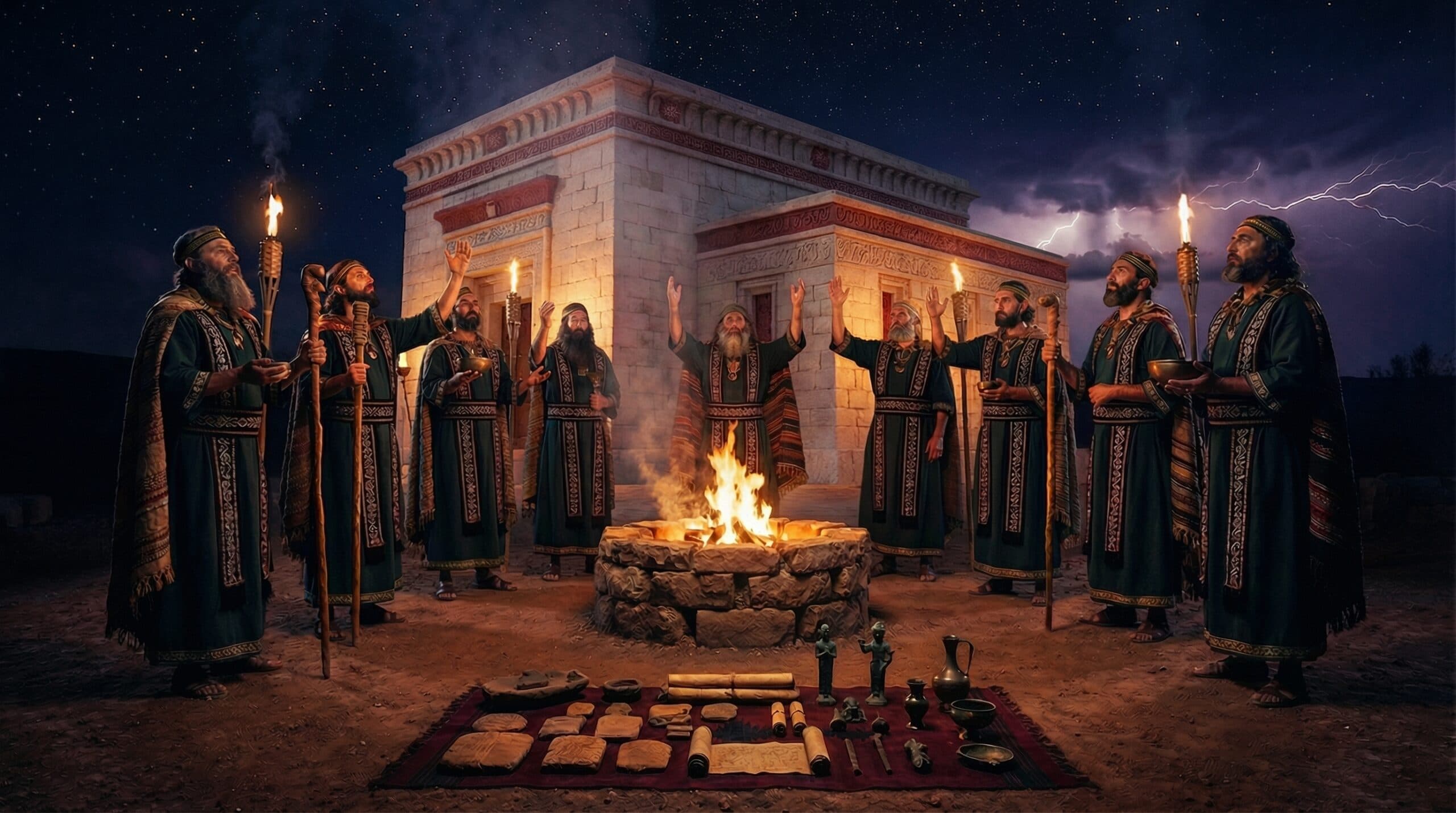
The valleys of the Middle Euphrates and the plain at the foot of Tur Abdin are therefore the regions where this "broken" plural, at first designating herds, is likely to have originated as a tribal name. This link to the natural world was also expressed in religious iconography, where the main god of the early Arameans, the Storm-god Hadad, was frequently depicted standing on the back of a bull. Although this iconographic pattern was inspired by Hittite religious art, it expresses the belief that the wild bull, which became the visible support of the anthropomorphic Storm-god, assists the "Aramean" totemic group.
The Crisis of the 11th Century and Expansion into Assyria
By the 12th and 11th centuries B.C., rural-pastoral Aramean tribes began to settle Syria peacefully, founding urban centers (e.g., ʿAin Dara) and initiating a process of re-urbanization. However, the relationship with the neighboring Assyrian empire turned volatile during the later part of the reign of Tiglath-pileser I (probably 1082 and 1081 B.C.) due to a severe famine. A Middle Assyrian chronicle describes this desperate situation, noting that "the people ate flesh of each other" to survive.
Pressured by starving Aramean tribes, the Assyrians fled to the mountains of Kirruri in the Zagros area, northeast of Erbil. The Arameans, described in the texts as "houses" or clans, advanced from Katmuhu, located on the eastern edge of Tur Abdin (the plain southeast of the mountain and east of the Tigris), and pushed their way into Assyria proper by advancing down the Tigris river, likely capturing Nineveh before Tiglath-pileser I could respond. To reach Katmuhu, Tiglath-pileser I "traversed the rough terrain of Kašiāri," likely using the main connection between Central Assyria and the Upper Tigris: the track from the Tigris valley to Savur, to Midyat, and onto the Sufan Çay plain. Following this expansion, the geopolitical identity of the region shifted. The inscriptions of the Assyrian king Ashur-bēl-kala (1073–1056 B.C.) simply refer to "the land of the Arameans" or "the Arameans" (KUR A-ri-me, KUR A-ri-mi, KUR A-ra-me), referring to the area of the Upper Khabur and Tur Abdin.
This designation marks a significant geopolitical shift, identifying the lands to the west and northwest of the Assyrian heartland as established Aramean domains. By the 1st millennium B.C., the Arameans had emerged as the predominant demographic force across Syria. Their ascent to political prominence was largely catalyzed by the power vacuum created following the collapse of the Late Bronze Age urban civilizations and the decline of the era's major empires.
Early Battles in Tur Abdin: The Campaigns of Ashur-bēl-kala
During the reign of Ashur-bēl-kala (1073–1056 B.C.), Kašiāri (Tur Abdin) is mentioned not only as a region where the king bred gazelles, ibex, and deer, but more importantly as the arena of a number of fights between the Assyrian army and the Arameans, who seem to have gained considerable control. From the inscription of the "Broken Obelisk," we learn about fights in the towns of Pa'uza, Nabula, Šūru, Hulzu, and Erišu, all located in the Kašiāri region.
In the month of Ayyāru, Ashur-bēl-kala fought the Arameans at the town of Pa'uza at the foot of the Kašiāri, and in the same month at the peak of the town of Nabula. Later, in the month of Abu, he vacated the town of Šūru in Hanigalbat and conquered Hulzu (inside Kašiāri) and Erišu. These sites can be identified with modern toponyms: Nabula is Girnavaz, a mound north of Nusaybin; Šūru is Savur; and Erišu is likely the same settlement as Irsia (mentioned later in 882 B.C.), located somewhere north/northeast of Savur.
The Aramean State of Bēt-Zammāni
One of the most significant political entities in the region was Bēt-Zammāni, an Aramean tribal state whose name derives from the eponym Zammān. This personal name occurs as early as the 18th century B.C. among Amorites (Za-am-ma-nu-um), and its root zamm connotes "to tie up," suggesting the meaning "fastener". Its capital was Amida, modern Diyarbakır, situated on a basaltic plateau on the right bank of the Tigris.
The city is still surrounded by masonry walls of black basalt which date back to the 4th-6th centuries A.D., giving it the Turkish name Kara-Amid or "Black Amid". Diyarbakır is at the head of the navigation of the Tigris and near exceptionally rich copper mines at Ergani-Maden. In 886 B.C., Tukulti-Ninurta II went on campaign against Bēt-Zammāni; to get there, he crossed the Kašiāri (Tur Abdin), starting out from the source of the river Supnat.
Geography of the Northern Aramean Territories
The territory of Bēt-Zammāni varied over time; its southern frontier generally followed the southern slopes of Tur Abdin, while the western boundary was the Karaça Dağ. The northern border was probably formed by the Arganasu (Nahr aḍ-Ḍīb) and the Tigris.
South of Diyarbakır, the slopes of the Karaça Dağ and the western part of Tur Abdin corresponded to the land Azalla or Izalla (also referred to as Zallaya), which was the territory of another Aramean tribal state called Bēt-Yahiri. This area is distinct from the Byt Șll mentioned in Sefire treaties, which was likely the kingdom of Kittik west of the Euphrates. To the west of Bēt-Zammāni lay another petty kingdom called Ašša, the ruler of which, Gēri-Dadi, paid tribute to Ashurnasirpal II in 866 B.C. This region likely corresponds to the area between Hilvan and Siverek, possibly the valley of the Çamdere river.
The Southern Arameans of Nisibis and Gidara
In the 1st millennium B.C., a specific Aramean group known as the Temanites managed to seize power in the Tur Abdin region. The name "Temanite" derives from the Aramaic root tymn, meaning "south" or "southern," implying a distinction between these clans and other "northern" Aramean groups. Their strategic center was Nisibis (modern Nusaybin), located on the borderland between the Tur Abdin range and the plain where the Čaġčaġ river passes through a narrow canyon.
The name Naṣībīn is of Aramaic origin and likely designated "sacred pillars" (naṣībīn), suggesting the city developed around a Semitic shrine with dressed sacred stones. Before the Aramean occupation, the site may have been known as Nawar or Nawali, possessing a famous shrine to the Storm-god. Another important center was Gidara, which had been conquered by Arameans during the reign of Tiglath-pileser II (967-935 B.C.). Gidara corresponds to Bughēdrā (apparently *Abū-Gidarā), situated about 20 km south of Mardin and 35 km northwest of Nusaybin. The Arameans referred to this city as Ra-qa-ma-tu (or Ra-dam-ma-te due to cuneiform confusion), a West Semitic name related to the root Rqm, similar to the name Rqm of Petra.
Military Conflict with Adad-nirari II
The Temanites were formidable foes of the Assyrians during the reign of Adad-nirari II (911–891 B.C.). In 898 B.C., Adad-nirari II attacked Gidara, where the Aramean ruler Mūquru offered stiff resistance. The name Mūquru is interpreted as an Aramaic passive participle (mawqur) meaning "honoured" or "venerable," rather than "deaf" or "overloaded" as previously suggested. The Assyrians were forced to use redoubts for the siege—a new tactic at the time—before Mūquru surrendered and was deported along with his brothers. The conflict continued in 896 B.C. against Nūr-Hadad, the ruler of Nisibis, who eventually surrendered and was carried captive to Nineveh.
Campaigns of 901-899 B.C. and the Western Thrust
In 901 B.C., Adad-nirari II claimed victory over Arameans "defeated from Pauza to Nisibis". Pauza is related to the Nahar Bawṣa (the upper course of the Jaghjagh), where about twelve fortified sites have been recognized. We see Pa'uza now in the control of Nūr-Adad of the Teman tribe, serving as a site of a battle involving chariotry. No precise identification for "the town of Pa'uzu at the foot of the Kašiāri" has been suggested so far, but from the description, it is clear that the site must be situated at the southern foothills of the Tur Abdin.
In 900 B.C., Adad-nirari II seized the town of Yaridu (meaning "market") and secured a great quantity of grain. In 899 B.C., he made a deep westward thrust to Huzirīna (modern Sultantepe, 16 km southeast of Urfa), securing the submission of towns at the foot of Tur Abdin (Mount Kašiyari) which had previously been seized by Mamli the Temanite. The ending -īna in Huzirīna suggests a Northsemitic or Westsemitic origin.
Diplomacy, Treaties, and Urartian Intersections
Relations between the Arameans and Assyria were complex, involving both war and diplomacy. Bēt-Zammāni appears in the annals of Tukulti-Ninurta II (890-884 B.C.) as an ally of Assyria against Hurrian and Urartian principalities. A formal pact was established with Ammī-ba'l, son of Zammān, who took an oath by Ashur.
The treaty included a curse: "If you give horses to my enemies... may Adad [strike your] land with his terrible lightning". The region also contained Urartian elements; a principality in the central part of Tur Abdin, in the valley of the Savur Çay, was ruled by a man named "Bi?-a-la-se", whose name may be Urartian (possibly related to Biainaše). This ruler may have been a predecessor of Lapturi, son of Ṭupusi, whose name appears to be the Assyrian rendering of Urartian Lutipri. Tukulti-Ninurta II eventually gained a victory over the city of Libb[a?] in the southern area of central Tur Abdin, using the nearby town of Patikkun (modern İstilil, Byzantine Φαθαχών) belonging to Bēt-Zammāni as a base.
Fortresses & Resettlement: The Ashurnasirpal II Era
The annals of Ashurnasirpal II mention that Arameans had captured the fortresses of Sinabu and Tīdu, which had been originally garrisoned by Shalmaneser I to face the Nairi lands. The Arameans likely captured these cities in the later half of the 11th century B.C. Ashurnasirpal II regained possession of these cities in 879 B.C., stating: "Assyrian people, who in Nairi had held the fortresses of Assyria on which the Arameans have trampled, I resettled in their abandoned cities (and) houses, (and) I placed them in a peaceful abode". One of the earlier campaigns by Ashur-bēl-kala in Tur Abdin had aimed at defending the cities of the district of Šinamu (Sinabu), but it does not seem to have been successful.
Ashurnasirpal II’s 879 B.C. campaign is described with considerable detail, offering a window into the geography of Tur Abdin at that time. The Assyrian army started from Tillê in the land Katmuhu, entered the Kašiāri mountains at the pass of Ištarāte, and spent the first night at Kibaki. The next day saw the attack and fall of the city of Matiātu. This is a crucial historical reference, as Matiātu corresponds to the modern city of Midyat. Apparently after having spent two nights there, the camp was set up at Zazabuha (night 4), and the next night was spent at a camp in Irsia.
His successor, Shalmaneser III, would later also cross Tur Abdin, against whom the Arameans would eventually rise and rebel.
Cultural & Linguistic Persistence in the Later Empire
Despite military defeats and deportations, the Aramean presence in the region was not extinguished. The gentilic Temanaya continued to appear in Assyrian records, such as in notes regarding "four Temanite sheep". The designation of the territory as the "Land of the Aramaeans" persisted, indicating that the Arameans remained the defining demographic. Furthermore, the Luwian hieroglyphic inscription of the ruler Yariris at Carchemish (early 8th century B.C.) mentions "the script of Taiman" alongside the scripts of Ashur (cuneiform) and Tyre (Phoenician). This "script of Taiman" likely refers to the "South-Arabian" script type designated by the Aramaic word for southern (taymān), known in Syria in the 8th century B.C. as shown by Hama graffiti.
Even after centuries of incorporation into the Assyrian empire, the region retained a distinct identity. Documents from the reign of Assurbanipal (668–630 B.C.) list vineyards located in Kašiāri to be exempted from taxes. Furthermore, a local dynast named Šumma-ilāni, titled "city ruler of Arkuhu which is in Kašiāri," is named in a court record from the early reign of this king. The fact that a local dynast is attested in the 7th century Tur Abdin, when the region had already been part of the Assyrian empire for centuries, is a good illustration of how remote and secluded parts of this mountain range were then, allowing the native population to maintain a degree of autonomy. Additionally, documents concern the sale of a vineyard in Nabul (Girnavaz) situated next to a "strong river" (the Gag-gag or Jaghjagh), further confirming the agricultural continuity of these Aramean settlements.